
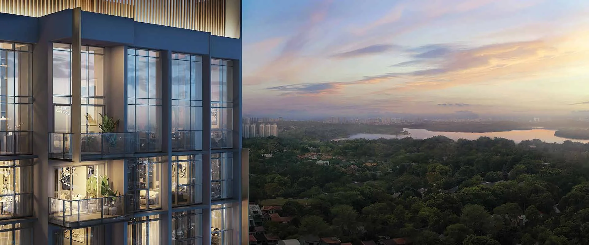
 Artist’s impression
Lentoria stands at 32, 36 and 38 Lentor Hills Road, District 26. Lentor station is about five minutes away on foot, by the developer’s count, and the Peirce reservoirs lie to the west.
Lentoria Location Map
Map centred on the site (1.38203, 103.83426). Open Lentoria in Google Maps.
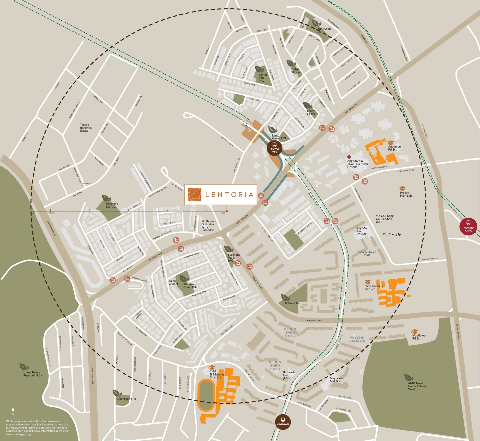
The site is a corner plot with a hilly contour, bounded by Lentor Hills Road, Lentor Gardens and Yio Chu Kang Road. Lentor station and the new homes of the Lentor estate lie to the north-east; the landed streets of the Teachers’ estate and Thomson Hills are close by, and the housing estates of Ang Mo Kio stretch to the east and south.
The postal codes follow the blocks: 788851 for Block 32, 788853 for Block 36 and 788854 for Block 38. OneMap lists the development as LENTORIA (U/C), under construction, at the three addresses on Lentor Hills Road.
The developer’s one-kilometre radius map shows what lies within a short walk: Lentor station, Anderson Primary School, CHIJ St. Nicholas Girls’ School, Presbyterian High School, Yio Chu Kang Secondary School, Ang Mo Kio 628 Market and several neighbourhood parks and playgrounds.
Lentoria Distances
Each figure below is a straight line on OneMap from the site, so the walk will be a little further. Read together, they map the everyday reach of Lentoria: a train station, two primary schools inside a kilometre, the markets of Ang Mo Kio and Upper Thomson, and the reservoir parks to the west.
Within about one and a quarter kilometres
| Destination | Straight-line distance |
|---|---|
| Lentor MRT station, Exit 4 (TE5) | about 390 m |
| Lentor MRT station, Exit 1 | about 410 m |
| Ang Mo Kio 628 Market | about 720 m |
| Yio Chu Kang Community Club | about 800 m |
| Anderson Primary School | about 830 m |
| CHIJ St. Nicholas Girls’ School | about 950 m |
| Presbyterian High School | about 990 m |
| Yio Chu Kang Secondary School | about 990 m |
| Mayflower Market and Food Centre | about 1.0 km |
| Yio Chu Kang MRT station (NS15) | about 1.2 km |
| Mayflower MRT station (TE6) | about 1.2 km |
| Sembawang Hills Food Centre | about 1.2 km |
About one and a quarter to nine kilometres
| Destination | Straight-line distance |
|---|---|
| Ang Mo Kio Town Garden West | about 1.3 km |
| Yio Chu Kang Stadium | about 1.4 km |
| Thomson Nature Park | about 1.4 km |
| Ang Mo Kio Polyclinic | about 1.5 km |
| Lower Peirce Reservoir Park | about 1.7 km |
| Bishan-Ang Mo Kio Park | about 1.9 km |
| AMK Hub | about 2.1 km |
| Upper Peirce Reservoir Park | about 2.6 km |
| Thomson Plaza | about 3.1 km |
| Junction 8 | about 3.9 km |
| MacRitchie Reservoir Park | about 4.5 km |
| Orchard Boulevard MRT station (TE13) | about 8.9 km |
Straight lines from the site on OneMap (SLA). The one walking time quoted on this site is the developer’s brochure figure; every other distance is a straight-line measurement. The Ministry of Education determines home-school distance for Primary One registration.
The neighbourhood around Lentoria
For decades Lentor was a quiet pocket of landed houses and old condominiums between Yio Chu Kang Road and the Seletar Expressway. The opening of Lentor station on the Thomson-East Coast Line, and the Government Land Sales sites around it, have turned it into a new private housing estate, and Lentoria is one of its developments.
Beyond the estate, the hawker centres of Ang Mo Kio and Upper Thomson are within about a kilometre, AMK Hub about two kilometres, and the city about eleven kilometres away.
Five area guides look further: Lentor MRT and transport, schools nearby, the reservoirs and nature parks, food and markets and shopping and malls.
Request the Lentoria Price List
Lentoria is open for sale. Ask the Sales Concierge for the current price list. Showflat viewings are arranged by appointment through the Sales Concierge.
What the Sales Concierge sends
- The price list and the homes that remain.
- The layouts on your shortlist and the e-brochure.
- The instalments due and the stamp duty for a chosen home.
- A viewing slot on a day you choose.
Request the Price List
No obligation. The Sales Concierge responds personally to every enquiry.
Rather talk it through? Call or WhatsApp the Sales Concierge on +65 6200 6220.